Pacific Isle Mapping
Peb 2025 · Publifye AS
E-book
61
Mga Page
family_home
Kwalipikado
info
reportHindi na-verify ang mga rating at review Matuto Pa
Tungkol sa ebook na ito
Pacific Isle Mapping explores the fascinating history of navigating and mapping the Pacific Ocean, contrasting European maritime records with the ingenious indigenous navigation techniques of Pacific Islanders. It argues that the mapping of the Pacific was not solely a European endeavor but was significantly shaped by the existing knowledge and navigational systems of Pacific peoples. The book challenges Eurocentric narratives by illuminating the sophisticated methods used by Pacific Islanders, such as star compasses and wave pattern interpretation, passed down through generations.
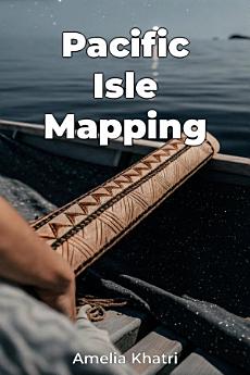
The book progresses by first establishing the historical context of European exploration, then transitioning to an in-depth examination of indigenous navigation techniques. A key focus is comparing European charts with indigenous conceptualizations of space, such as the stick charts of the Marshall Islands, highlighting their unique approaches to maritime records. By integrating both perspectives, the book provides a comprehensive re-evaluation of Pacific history, acknowledging the active role Pacific Islanders played in shaping the world's understanding of their region.
I-rate ang e-book na ito
Ipalaam sa amin ang iyong opinyon.
Impormasyon sa pagbabasa
Mga smartphone at tablet
I-install ang Google Play Books app para sa Android at iPad/iPhone. Awtomatiko itong nagsi-sync sa account mo at nagbibigay-daan sa iyong magbasa online o offline nasaan ka man.
Mga laptop at computer
Maaari kang makinig sa mga audiobook na binili sa Google Play gamit ang web browser ng iyong computer.
Mga eReader at iba pang mga device
Para magbasa tungkol sa mga e-ink device gaya ng mga Kobo eReader, kakailanganin mong mag-download ng file at ilipat ito sa iyong device. Sundin ang mga detalyadong tagubilin sa Help Center para mailipat ang mga file sa mga sinusuportahang eReader.