Pacific Isle Mapping
феб 2025. · Publifye AS
E-knjiga
61
Stranica
family_home
Ispunjava uslove
info
reportOcene i recenzije nisu verifikovane Saznajte više
O ovoj e-knjizi
Pacific Isle Mapping explores the fascinating history of navigating and mapping the Pacific Ocean, contrasting European maritime records with the ingenious indigenous navigation techniques of Pacific Islanders. It argues that the mapping of the Pacific was not solely a European endeavor but was significantly shaped by the existing knowledge and navigational systems of Pacific peoples. The book challenges Eurocentric narratives by illuminating the sophisticated methods used by Pacific Islanders, such as star compasses and wave pattern interpretation, passed down through generations.
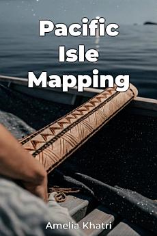
The book progresses by first establishing the historical context of European exploration, then transitioning to an in-depth examination of indigenous navigation techniques. A key focus is comparing European charts with indigenous conceptualizations of space, such as the stick charts of the Marshall Islands, highlighting their unique approaches to maritime records. By integrating both perspectives, the book provides a comprehensive re-evaluation of Pacific history, acknowledging the active role Pacific Islanders played in shaping the world's understanding of their region.
Ocenite ovu e-knjigu
Javite nam svoje mišljenje.
Informacije o čitanju
Pametni telefoni i tableti
Instalirajte aplikaciju Google Play knjige za Android i iPad/iPhone. Automatski se sinhronizuje sa nalogom i omogućava vam da čitate onlajn i oflajn gde god da se nalazite.
Laptopovi i računari
Možete da slušate audio-knjige kupljene na Google Play-u pomoću veb-pregledača na računaru.
E-čitači i drugi uređaji
Da biste čitali na uređajima koje koriste e-mastilo, kao što su Kobo e-čitači, treba da preuzmete fajl i prenesete ga na uređaj. Pratite detaljna uputstva iz centra za pomoć da biste preneli fajlove u podržane e-čitače.